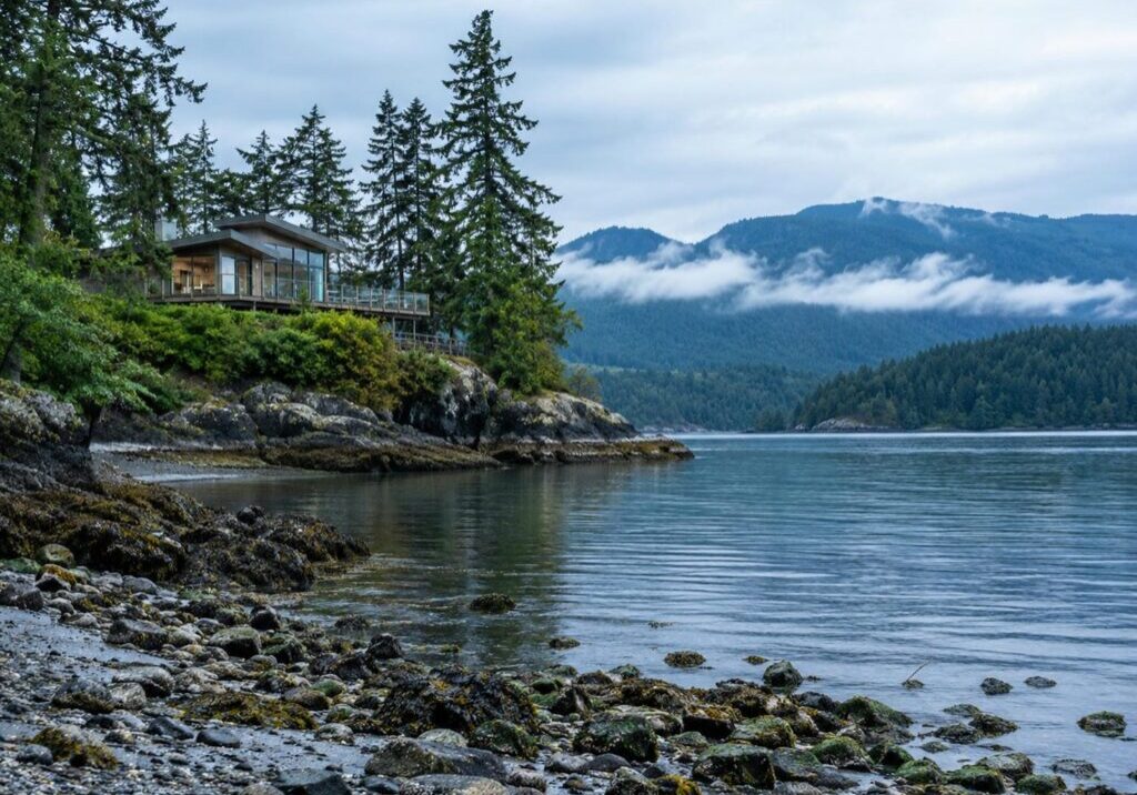
On a waterfront lot, one of your boundaries is not a surveyed line at all. It is a physical feature of the shoreline, and it moves, which is why buying waterfront property in BC runs on a different set of checks than an interior lot. Everything a buyer normally verifies sits on top of the land. On a shoreline the land itself is the open question. How much of it you are getting, where a house can sit, who owns the beach and the dock, and what lies under the ground all stay open until someone competent stands on the site.
Each of those questions has a person or an office whose job it is to answer it, and the order you ask them in decides what the verification costs. Reading a shoreline before the price is fixed is the front half of the work for a waterfront custom home builder.
What You Are Actually Buying on a Waterfront Property in BC
Most boundaries on a title are measured. On a waterfront parcel the seaward or lakeward one is described instead, in words about what the water does to the ground. That is why the ordinary lot checklist stops being complete around the top of the beach.
The Water’s Edge Is a Mark on the Ground, Not a Line on a Plan
The legal edge of your property is the visible high water mark. The Land Act defines it as the point where the water’s presence and action are so common, so usual, and so long continued in all ordinary years that they mark the soil with a character distinct from the bank above it, in vegetation and in the nature of the soil itself.
That is a physical test, not a geometric one. Nobody locates it from an office or a listing photograph, because it is a change in the ground a person has to stand in front of and identify. Because the mark is made by what the water habitually does, it shifts when the shoreline shifts.
What Sits Below That Line Is Not Yours to Buy
Below the natural boundary is the foreshore, the land between the high and low water marks, and it is not part of what you are buying. In British Columbia the provincial government owns nearly all foreshore, fresh water and salt water alike. So a waterfront purchase does not buy a private beach, and anything on the water side of that line is a permissions question rather than a fixtures question.
A strong title does not change that. Unless the original Crown grant expressly said otherwise, no part of the bed or shore below the natural boundary passed to the owner, even against an indefeasible title. Private moorage must also leave public access along the foreshore unobstructed.
What Changes on a Waterfront Lot and What Does Not
Zoning, servicing capacity, soils and the ordinary title work behave the same way here as on any other lot. Five other things do not, because each one is tied to a line that moves:
- The area you are buying, which has been changing since the day the plan was drawn.
- The setback, measured from the water rather than from the road.
- The flood construction level, derived from the water for the same reason.
- The ownership of anything on the water side of the line, including the dock.
- The strip of the lot closest to the water, which carries restrictions the rest of the parcel does not.
Erosion and Accretion: The Boundary Moves and the Title Does Not Follow

A plan on file records a shoreline as it was on the day a surveyor walked it, and on plenty of BC waterfront parcels that day was decades ago. The shoreline has been moving ever since, in one of two directions with opposite consequences for a buyer.
Land Lost to Gradual Erosion Stops Being Yours
When the upland erodes gradually and imperceptibly, the land that is lost becomes part of the foreshore or the bed of the adjacent water body, and it becomes Crown land. Say that in the direction it runs: it stops being yours. The plan still shows it. The title still describes it. The record does not update itself, and the fact that it has not changed does not mean the ownership has not.
So the parcel described on the plan can be larger than the parcel that exists. On a bank that has been giving up ground for decades, what went is the ground nearest the water, usually where the buyer was picturing the house. The Land Title and Survey Authority states the rule in those terms.
Accretion Does Not Add Itself, and Fill Does Not Count
Land that has built up against the upland through gradual and imperceptible natural deposition can belong to the owner, but only as an outward growth from the upland, and only once it has been claimed. A visibly wider beach puts nothing on the title by itself. Somebody has to apply, and somebody has to certify it.
Then the limit. Waterfront owners do not own land created by a sudden deposit of material in a flood, by an artificial interference with natural processes, or by the addition of fill. A seller who widened a beach with trucked-in fill has created nothing to sell.
When the Plan Was Wrong to Begin With
There are two different problems here, with two different remedies. One is that the boundary genuinely moved through natural deposition, which is an accretion claim. The other is that an old plan of waterfront property simply drew the natural boundary in the wrong place at the time, which is a natural boundary adjustment.
The evidence each one needs is different. For a natural boundary adjustment, the applicant has to show that the water’s edge sits today where it sat at the time of the original survey. Only a BC land surveyor standing on the beach with the old plan can tell you which of the two you are looking at.
How the Application Runs, and What It Costs You in Time
An owner cannot file either application themselves. It goes to the Surveyor General through a BC land surveyor’s account, and it is an adjudicated decision with an evidentiary threshold rather than a filing. The application is referred out for comment to provincial staff and to local governments that asked to comment, and only once those comments come back does the Surveyor General decide. If approved, the certified plan has to be deposited in the land title office before the title changes, which is why a private survey on its own does not move a boundary.
Two things belong in the buyer’s arithmetic. The decision runs on referral time rather than on your timeline, so treat it as a schedule item from the first week, and the application carries a filing fee on top of the survey. Ask your surveyor to price the whole package in writing before the offer.
A start date that depends on a decision nobody can date is a start date you cannot commit trades against, which is why an open boundary question belongs in the offer and not in the closing file.
The Survey You Actually Need, and the Plan That Is Already on File

Most buyers assume a plan on file settles where the boundaries sit. Often it does not. A plan is a category of document rather than a single one, and the types that end up on a title carry different levels of scrutiny.
Your Title Guarantees Ownership, Not Where the Edges Are
BC’s title system is conclusive about who owns a parcel. It is not conclusive about where the edges of that parcel are. The land title legislation says so in as many words: the provision that makes a registered title conclusive evidence of ownership expressly preserves the right of a person to show that land was improperly included in that title through a wrong description of boundaries.
Ownership is guaranteed. The description of the boundaries is not, and on a shoreline that description is the part that has been moving.
Not Every Plan on File Is a Decision About Your Boundaries
A posting plan can be accepted for filing at the land title office and look, to a buyer, exactly like a survey. Acceptance of it is expressly not a determination by the registrar of where the parcel’s boundaries are. Subdivision plans and reference plans go to the Surveyor General for review and approval. So the plan behind the seller’s title may well be the light one, and nothing on its face says so.
The same confusion turns up on ordinary lots, where the difference between a site survey, a site plan, and a grading plan decides which drawing anyone can rely on. A waterfront parcel adds one more question: what each document tells you about the water’s edge, which for most of them is nothing about today.
| Plan or Document | What It Is | Who Reviews or Approves It | What It Tells You About the Water’s Edge |
| Registered subdivision plan | The survey plan that created the parcel | Reviewed and approved by the Surveyor General | The water’s edge on the day of that survey, which may be decades ago |
| Reference plan | A survey plan filed to define part of a parcel | Reviewed and approved by the Surveyor General | Accurate to its own date, not to today |
| Posting plan | A plan accepted for filing at the land title office | Accepted by the registrar, no Surveyor General approval | Expressly not a decision about where the boundaries are, water boundary included |
| A current survey by a BC land surveyor | A field survey you commission | Not filed, unless it becomes an application to the Surveyor General | Where the water’s edge sits today, which the other three cannot give you |
When to Order the Survey, and What Title Insurance Does Not Tell You
Order the survey inside the subject period, before the price is fixed, because the result can change what the lot is worth to you. A survey is priced per property, and a waterfront parcel costs more than a flat interior lot because the surveyor has to locate the water’s edge as well as the corners.
Buyers ask every time whether title insurance makes the survey unnecessary. A policy and a survey do different jobs. A policy answers problems with the title. It does not tell you where the water sits today, and wordings differ between insurers, so ask yours in writing whether the water boundary is covered before you decide to skip the survey.
Gradual change is what moves the line. A shoreline that failed overnight in a storm or a slide is a different question, for your surveyor and your lawyer on the facts of that beach. What the survey changes is the position of the buildable envelope, and with it the footprint any design can use.
The Dock: What a Buyer Confirms Before Closing

A dock is often the most valuable improvement on a waterfront listing and the one buyers understand least. Three questions settle it: does it need permission, what permission is it holding, and how do you check without taking the seller’s word for it.
A Dock Sits on Crown Land, So It Needs Permission
The construction, placement and use of private moorage on Crown land requires authorization from the provincial government. A dock is not an appliance, and it does not convey the way a fixture conveys, because the ground under it is not ground the seller owns.
There is a second consequence sellers rarely raise. Private moorage must not obstruct public access along the foreshore, so the dock does not come with a private stretch of beach around it.
General Permission, Specific Permission, or Lease: Which One Actually Transfers
There are three routes, and they behave very differently on a sale.
Under a general permission, a dock built and used in accordance with the stated conditions is deemed authorized. There is no document and nothing to transfer. What the buyer inherits is a dock that either meets the conditions or does not, and if it does not, the buyer inherits an application.
Under a specific permission or a lease there is a tenure, and it does not follow the sale. It cannot be assigned or sub-tenanted without the provincial government’s permission, and the holder carries obligations, including annual rents and property taxes.
Parts of the South Coast mainland are designated application-only areas, so a general permission does not apply there and a dock needs its own approval. Whether a stretch of shoreline sits inside that area is a question for FrontCounter BC, and the answer changes what an existing dock is worth to you.
How to Check, Rather Than Take the Seller’s Word
Existing tenures and tenure applications are recorded in the provincial Crown land registry, and the public can search it through GATOR, which shows the leases, licences and reserves recorded against a parcel. A buyer, or their notary or lawyer, can run that search during the subject period instead of relying on the listing.
Read the result in one direction only. Because a general permission requires no application, finding no tenure record does not by itself mean the dock is unauthorized.
A dock does not show up on a title search the way a mortgage does, so have someone confirm which of the three applies before you close. New applications go through FrontCounter BC, and one next to water may need a consent letter from the upland owner.
The Archaeological Check Most Buyers Have Never Run
This is the check missing from an ordinary lot checklist, and the one with the least slack in it if it surfaces late. Protection here does not depend on anyone having recorded anything, and it does not stop at the edge of private land.
Protection Does Not Depend on Anyone Having Recorded the Site
Archaeological sites on public and private land are protected whether they are known or not, and they must not be altered without a permit. That is true of every property in British Columbia, not only waterfront ones.
Two things follow for a buyer. Being on private land changes nothing about the protection. And the number of recorded sites is not the number of sites: over 64,000 heritage sites are recorded across the province, 90 percent of them of First Nations origin, and that is a count of what has been found.
On a Waterfront Lot, the Sites Usually Sit Where the Setback Already Is
On a waterfront property, protected sites usually sit close to the water, and they are often contained within the same setbacks that already restrict that strip for environmental reasons. Usually and often, not always.
That tells a buyer which part of the lot to ask about first, and it means the part of the parcel that is hardest to build on for one reason is often carrying this question too. What it does not mean is that a house planned well back from the water is outside the question, because protection does not follow the setback line.
How to Find Out Before You Are Committed, and Who Pays
Three routes lead to an answer before you are committed. You can hire a private consulting archaeologist. You can talk to your local government. Or you can submit an archaeological information request, which costs nothing to file and is open to property owners and to land title conveyancing professionals, so your notary or lawyer can submit it during the subject period.
The sequence is also the cheaper order. You assess first, under a heritage inspection permit, to establish whether a site is present and what an impact would be. Only if a site is present do you apply for permission to alter it, and that second application can be refused as well as granted. A buyer should hear that before pricing the lot, because a refusal is not a delay. It is a different house.
On cost, the Province is direct. Property owners and developers are responsible for the costs of archaeological work, and those costs can be minimized by taking early action and keeping the impact low. No public map answers the question at the level of a specific lot, so the free request comes first and a consulting archaeologist’s read of the ground second.
How Much of the Lot You Can Actually Build On

Two lines control how much house a waterfront lot can hold, and both are measured from the shoreline rather than from the road, so both move when the shoreline does. Neither is a number to guess at from a listing.
The Setback Is Measured From a Line That Moves
Beside a stream, the riparian assessment area is a 30 metre strip on each side, measured from the stream boundary. That boundary is the same physical test as the water’s edge: the visible high water mark the water’s habitual action leaves on the soil, or the boundary of the active floodplain, whichever sits farther from the centre. A moving edge therefore moves the assessment area, and that area is much of what decides how much of the lot is buildable. Where it falls is the clearest illustration of how BC’s environmental rules land on a build.
The Flood Construction Level Comes From the Water, Not the Road
Required floor elevations and building setbacks in coastal areas are keyed to the shoreline, and since 2018 the provincial guidelines fold a sea level rise allowance into how they are determined. The binding numbers are municipal, because local governments can develop flood hazard bylaws without provincial approval. So ask the municipality for the setback and the flood construction level for that parcel, in writing.
On a constrained coastal lot those two numbers can leave a footprint far smaller than the lot area suggests, and they set the finished floor height before anyone has drawn a line.
Reading the Title and the Site History
A survey tells you where the lot is. The title and the site’s past tell you what you are allowed to do on it, and on a shoreline both carry things an interior lot does not.
The Charge on the Title Can Bind You More Than the Zoning Does
On low-lying or waterfront properties there may be a restrictive covenant registered on the title, setting a minimum building elevation for habitable space or minimum setbacks from bodies of water. Any plan for redevelopment has to be consistent with its terms. Where there is no covenant, an owner may be required to enter into one at building permit or as part of a development application. Delta is explicit about this and publishes minimum flood elevations on its mapping tool.
Treat that covenant as a design instruction rather than paperwork. It sets the main floor height, which drives the driveway grade, the garage, the entry sequence and how the house meets the ground. The buyer inherits that decision at purchase.
How You Legally Reach the Lot
Some waterfront parcels are reached by water. Some by a shared driveway held under an easement. Some across land belonging to somebody else. How you legally get to the lot is part of the title search, and it is worth settling early.
The builder’s half of that question is the one buyers miss. Access decides how material reaches the site, what equipment can get there, and whether the build carries a barge or a long crane reach. Those costs land on the build rather than on the purchase, which is why they belong in the purchase decision.
A Shoreline With an Industrial Past
Former mill sites, log sorts, boatyards, fuel docks and canneries were all shoreline operations. Where a property has had one of the listed industrial or commercial uses, a site disclosure statement is required at sale and goes to the prospective buyer. Municipal permit approvals are restricted until a certification document or a release notice is obtained from the ministry, so a contaminated history stalls the building permit rather than simply complicating the price.
The provincial site registry can be searched, and site IDs and basic location information can be viewed at no cost through iMapBC. The existence or absence of information in the registry provides no assurance that a site is or is not contaminated, so a clean search is not a clean site.
Who You Need on the Team, and What Goes in the Offer

Everything above is a question with somebody whose job it is to answer it. Lining those people up in the right order is what keeps a waterfront purchase from becoming a run of expensive surprises after the subjects come off.
The Five Questions, and Who Answers Each One
Where does the water’s edge sit today? A BC land surveyor, who is also the only person able to file a boundary application on your behalf. What do the charges and the access arrangements say? A lawyer or notary, who can also submit the free archaeological information request. What is under the ground? A consulting archaeologist. What are the setback and the flood construction level here? The municipality, in writing. What is the situation on the water side? FrontCounter BC.
Two of those five are government offices rather than professionals you retain. Anything needing a Crown decision on the water side carries a referral step, including consultation with First Nations, and referral steps take the time they take.
Price the Findings Into the Offer, Not the Closing Costs
The survey, the archaeological work and any boundary application are inputs to the offer price rather than closing costs. Each one can change what the lot is worth or whether it works at all.
Run them in this order:
- Run the title search and read the charges, not just the ownership line.
- Submit the archaeological information request. That one is free.
- Search the site registry for the property’s history. Site IDs and basic location information cost nothing to view.
- Ask the municipality for the setback and the flood construction level in writing.
- Check the Crown land registry for a dock tenure.
- Order the survey. It is priced per property and runs higher on waterfront than on a flat interior lot.
- Get quotes for whatever the first six turn up, then decide the price.
The first five cost little or nothing, which is what makes that order worth following. Two items can genuinely move a budget: a boundary application, which is a survey plus a filing fee running on referral time, and archaeological work where a site is present, which the property owner pays for. That is most of what pushes waterfront due diligence above what an interior lot asks for, and what the first six turn up also feeds the approvals budget, which follows the same logic as what permits cost on a BC custom home anywhere in the province.
Bring the Site Questions Forward Before the Price Is Fixed
The questions above decide whether a design is possible on a given lot, and they are cheapest to answer while an offer is still conditional. Versa Homes builds on coastal and shoreline sites around Greater Vancouver, and we have watched a setback line and a flood construction level together erase most of a usable lot. We would rather read those constraints with a client before the purchase than work around them afterward.
A fixed-price contract can only be fixed on a site whose constraints are known, and a detailed build schedule with pre-booked trades only survives if the approvals that run on referral time were identified first. Both sit at the centre of how we handle custom home construction.
If there is a waterfront lot in front of you and a subject removal date coming, start a conversation with our team while the price is still open.
Frequently Asked Questions
Does a Waterfront Lot’s Size Change Over Time?
Yes, and the title record does not update itself. When the upland erodes gradually and imperceptibly, the land lost becomes part of the foreshore or the bed of the water body and becomes Crown land, even though the plan on file still shows it inside the parcel. Gradual natural deposition can work the other way and add land, but only as an outward growth from the upland and only once it has been applied for and certified. So the parcel on the plan and the parcel that exists can be two different sizes.
The Beach in Front of the Lot Is Wider Than the Plan Shows. Do I Own It?
Not automatically, and possibly not at all. For that width to belong to the upland owner it has to have built up gradually and imperceptibly through natural deposition, as an outward growth from the upland, and it has to be applied for and certified before it reaches the title. Land created by a sudden deposit in a flood, by an artificial interference with natural processes, or by the addition of fill is not the owner’s land in any event.
The Property Already Has a Plan on File. Do I Still Need a Survey?
Usually yes, and the reason is what the plan is. A posting plan can be accepted for filing without that acceptance being a determination of where the boundaries are, so it settles nothing about the water’s edge. An approved subdivision or reference plan carries more weight, but it is accurate to the day it was surveyed, which on a shoreline may be decades back. Only a current survey by a BC land surveyor locates the water’s edge as it exists today.
Does the Dock Come With the Property?
The dock does. The permission may not. If it sits under a general permission there is no document and nothing to transfer, only conditions the dock either meets or does not, and if it does not, the buyer inherits an application. If it is held under a specific permission or a lease, that tenure cannot be assigned or sub-tenanted without the provincial government’s permission. Ask which of the three applies before the subjects come off.
Can I Stop People From Walking Along the Beach in Front of My House?
Almost certainly not. The land below the natural boundary is Crown land in nearly every case in British Columbia, so the beach in front of the house is not part of what you bought, and private moorage must not obstruct public access along the foreshore. What you can and cannot do about people on the beach turns on the facts of that particular shoreline, so put that question to your lawyer.
Can I Find Out About Archaeological Sites Before I Make an Offer?
Yes. An archaeological information request can be submitted on the property at no charge, and it is open to private property owners as well as to land title conveyancing professionals, so a notary or lawyer can run it during the subject period. A consulting archaeologist reads the ground after that, and that order is what keeps the cost down. No public map answers the question at the level of a single lot.
The Lot Was a Boatyard. Does That Change Anything?
Yes. Where a property has had one of the listed industrial or commercial uses, a site disclosure statement is required at sale and goes to the prospective buyer, so ask for it early. Municipal permit approvals are restricted until a certification document or a release notice is obtained from the ministry, so a contaminated history can stall the building permit rather than just affect the price. A registry search helps, but the absence of information in it is no assurance that a site is not contaminated.
Is Title Insurance a Substitute for a Survey on a Waterfront Lot?
They do different jobs. A policy answers problems with the title. It does not tell you where the water sits today, which is the question a waterfront survey exists to answer. Wordings differ between insurers, so if you are thinking of skipping the survey, ask your insurer in writing whether the water boundary is covered. On a parcel where the setback and the flood construction level are both measured from the shoreline, that line is a design input as much as a legal one.


Felipe Freig
Founder of Versa Homes
Felipe Freig is the founder of Versa Homes, a Vancouver custom home builder known for architecturally driven, fixed-price projects. With years of hands-on site experience and deep permitting and by-law knowledge, Felipe leads high-performance teams that deliver precision craftsmanship, clear budgets, and on-schedule luxury homes.
You May Also Like...
What Should a Builder Charge to Build a Custom Home

Questions To Ask Builder References Before You Sign

What’s Public and What Isn’t: Your Custom Home in B.C. Permit Records

Soundproofing An Executive Home Office In A Custom Home
Starting with a Builder is Key to Staying Within Budget When Building


Understanding the Importance of Electrical Rough-In Before Insulation
Elevating Outdoor Living Spaces: Inspiring Ideas for Luxury Custom Homes in Vancouver